

Vizsla Silver Accelerates Exploration as Company Hunts for Project 2 Beyond Flagship Panuco


Vizsla Silver expands exploration program, completes geophysical surveys identifying new targets, and advances Santa Fé property development plans.
- Vizsla Silver has completed over 390,000 metres of diamond drilling at its flagship Panuco project, establishing a robust resource base of 222.4 million ounces silver equivalent measured and indicated, with 138.7 million ounces inferred.
- The company has completed a comprehensive geophysical survey covering the Copala and Napoleon vein corridors, identifying multiple new near-surface anomalies that could expand Project 1 resources.
- Vizsla Silver is actively pursuing "Project 2" through systematic exploration across the broader Panuco district, with 158 targets identified and 43 already drill-tested using advanced geological mapping and sampling.
- The recent acquisition of Santa Fé property provides immediate production infrastructure including a 350 tonne per day mill and six identified near-mine vein targets within an 800-hectare area.
- The company has expanded its land package to over 47,000 hectares through strategic acquisitions of La Garra, San Enrique, and Santa Fé properties, representing a 650% increase in the emerging Western Mexico Silver Belt.
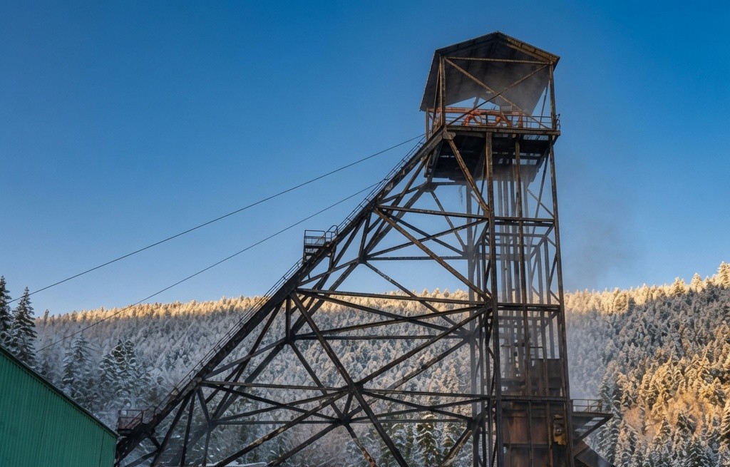
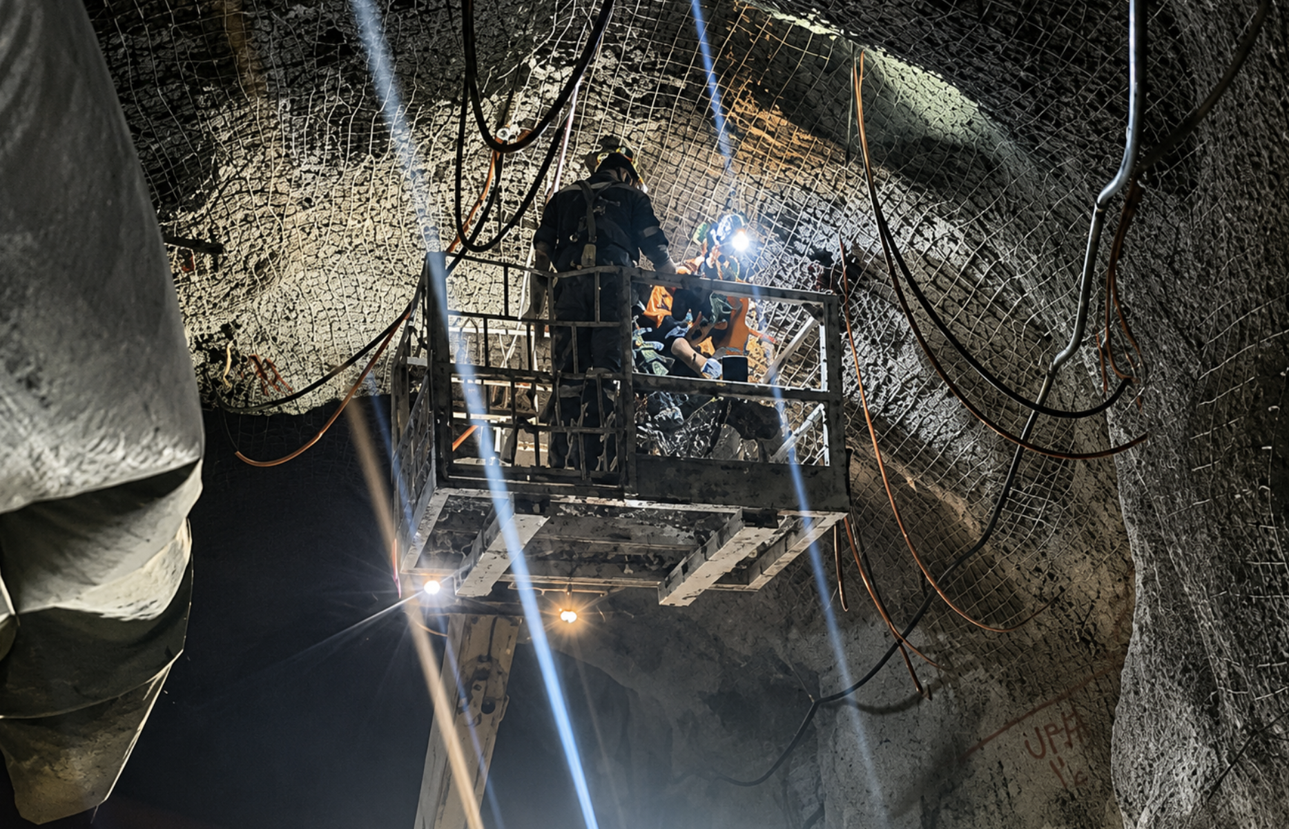
Vizsla Silver Corp. (TSX: VZLA, NYSE: VZLA, Frankfurt: 0G3) operates the consolidated Panuco silver-gold project, an emerging high-grade discovery located in southern Sinaloa, Mexico, near Mazatlán. The company controls a 7,189.5-hectare past-producing district that benefits from over 86 kilometres of total vein extent, 35 kilometres of underground mines, and existing infrastructure including roads, power, and permits. The district contains intermediate to low sulfidation epithermal silver and gold deposits, with current mineral resources totaling 222.4 million ounces silver equivalent measured and indicated, plus 138.7 million ounces inferred as of January 2025.
Strategic Exploration Framework: Dual-Track Approach
Vizsla Silver has implemented a comprehensive exploration strategy focused on two primary objectives: enhancing the existing Project 1 resource base while simultaneously hunting for Project 2, a new mineralized center with comparable resource potential.
Michael Konnert, CEO, outlined the company's strategic direction, stating:
"Since our initial discovery at Napoleon we have completed over 390,000 metres of diamond drilling, made several new discoveries and outlined a robust, high-grade resource base which serves as the foundation for Panuco Project 1, located in the southwest corner of the district. We are now determined to identify the next epicenter of high-grade mineralization with the potential to host similar resources to that outlined in Project 1."
The company's systematic exploration approach has yielded significant geological insights, with Project 1 currently hosting approximately 98% of the district's mineral resources and serving as the focus for the pending Feasibility Study. This concentration provides a solid foundation while highlighting the substantial exploration upside across the broader district.
Project 1 Enhancement Strategy
.png)
Resource Extension Targets
The recently completed ground High-Resolution Electromagnetic (HLEM) survey has identified multiple opportunities to expand existing resources within established vein systems. The Copala structure remains open both down-dip to the south and along strike to the north, with recent discoveries of historic workings and near-surface high-grade mineralization indicating potential for additional shoots extending to surface.
The Napoleon HW4 represents a particularly compelling target, described as a shallow-dipping vein that splays eastward from the main Napoleon Vein. Multiple high-grade intercepts along this structure support potential resource expansion down-dip to the east. Similarly, La Luisa remains open at depth and along strike, with updated geological modeling suggesting two potential feeder zones that warrant future drill testing.
Proximal High-Priority Targets
The exploration team has identified several proximal targets within potential hauling distance of the proposed processing location. The Colorada-Napoleon intersection represents a conceptual target at the projected intersection of the Copala fault and northern Napoleon extent, where geological conditions suggest favorable structural preparation. This interpretation is supported by preliminary artificial intelligence and machine learning analysis, with the recent HLEM survey revealing multiple conductor anomalies that deviate from established trends.
The 4de Mayo target consists of narrow subvertical veins located one kilometer west of La Luisa, where exploratory drilling has reported high-grade silver intercepts near surface. Ground HLEM geophysics has identified compelling anomalies along and south of this vein system, supporting the case for follow-up exploration drilling.
Project 2 Discovery Initiative
Geological Evidence for Multiple Centers
The hunt for Project 2 is supported by compelling geological evidence indicating multiple mineralized centers across the district. Age dating analysis has revealed a significant temporal gap between mineralization events, with epithermal mineralization at Copala and Napoleon dated at 25.81 ± 0.05 Ma and 25.72 ± 0.06 Ma respectively, while sericite alteration at the Guayanera dome along the Animas vein trend dates to 32.14 ± 0.17 Ma.
Konnert emphasized the significance of this discovery:
"The age gap of ~6 Ma between epithermal mineralization in the west and hydrothermal alteration (activity) farther east, supports the hypothesis that multiple hydrothermal centers operated in the district over time."
Systematic Target Generation
Since district consolidation, Vizsla Silver has conducted detailed geological mapping covering 68% of the district at 1:1,000 scale, collecting over 5,000 rock chip samples. This comprehensive approach, supported by LiDAR surveys and enhanced by integration of Terraspec data, WorldView-III, and ASTER satellite imagery, has enabled identification of 158 targets district-wide, with 43 already drill-tested.
A notable success from this systematic approach includes the recent discovery at La Pipa target along the Animas vein system, where hole AM-25-90 intercepted 653 g/t silver, 4.26 g/t gold, 0.02% lead and 0.04% zinc over 5.80 metres true width, demonstrating the potential for high-grade discoveries beyond Project 1.
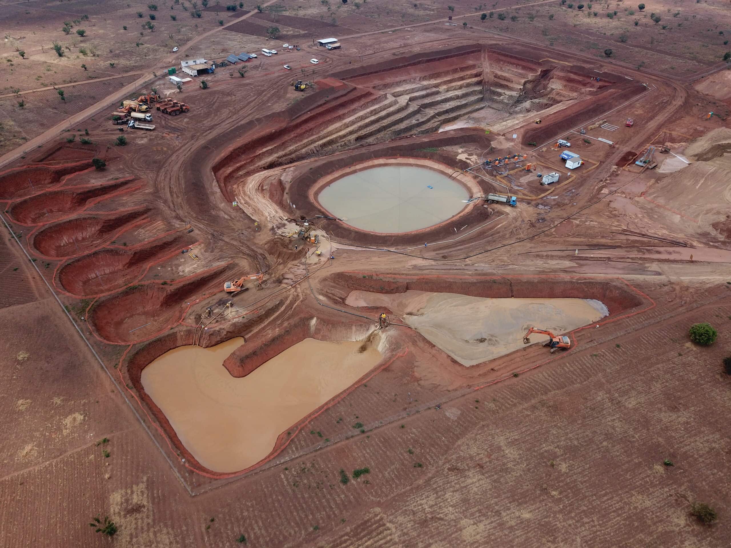
Santa Fé Property Development
Production Infrastructure Advantage
The acquisition of Santa Fé provides immediate strategic advantages through existing production infrastructure, including an operating 350 tonnes per day mill. The property's mining history extends to the Spanish era, with recent operations between 2020 and 2024 processing 370,366 tonnes of ore with average head grades of 203 g/t silver and 2.17 g/t gold.
The Santa Fé, or Mother Vein, exhibits classic low sulfidation epithermal characteristics and has been drill-tested along approximately 1,050 meters of strike length. Six near-mine vein targets have been identified within an 800-hectare area: Santa Fé HW, San Jose, San Jose North, Rosarito, Tahonitas, and Natalia, with previous drilling by Aurico and Fortuna returning anomalous to significant silver and gold values.
Near-Term Development Timeline
Vizsla Silver has commenced detailed mapping and analysis of existing drilling and geophysical data, targeting generation of near-mine drill targets by the end of Q3 2025. Subject to exploration results, the company plans to initiate drilling before year-end, providing potential near-term catalysts for resource expansion.
Regional Expansion Strategy
.png)
Land Package Growth
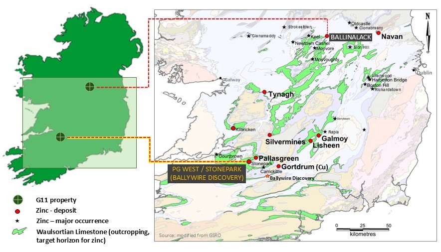
The strategic acquisitions of La Garra, San Enrique, and Santa Fé properties have increased Vizsla Silver's land package to over 47,000 hectares, representing a 650% increase within the emerging Western Mexico Silver Belt. This expansion adds significant blue-sky exploration potential beyond the initial Panuco District.
The San Enrique prospect comprises 10,667 hectares strategically positioned between Panuco and Santa Fé, with LiDAR and airborne magnetic surveys revealing strong northwest-trending lineaments indicative of regional fault systems. Two lineaments appear aligned with southeastern extensions of the Copala fault and Cordon del Oro-Animas vein structures from Panuco, suggesting structural continuity across the broader district.
La Garra District Potential
The La Garra-Metates District covers 16,962 hectares approximately 32 kilometers north-northwest of Panuco and 32 kilometers south-southwest of First Majestic's San Dimas mine. Initial sampling across two principal vein systems returned encouraging results, with fourteen rock chip samples achieving silver equivalent grades greater than 200 g/t, including 2.22 to 12.30 g/t gold and 22 to 1,156 g/t silver.
2025 Exploration Program
Comprehensive Survey Initiative
For the remainder of 2025, Vizsla Silver will continue its fully funded 25,000-metre exploration drill program, with approximately 8,000 metres already completed. The program targets vein extensions and geophysical anomalies at Colorada North, Napoleon-Copala fault intersection, Animas (La Pipa), and potential blind veins along three east-west oriented drill fences in Panuco West.
Additional district-wide initiatives include a time domain Electromagnetic survey and airborne geophysical survey covering over 1,000 line-kilometers. Data integration from these surveys with existing geological, geochemical, alteration, and multispectral datasets will refine exploration targeting and guide the search for new mineralization zones.
Financial & Operational Considerations
The current mineral resource estimate provides a solid foundation for development, with 222.4 million ounces silver equivalent measured and indicated resources, plus 138.7 million ounces inferred. This resource base, concentrated primarily in Project 1, serves as the foundation for the pending Feasibility Study while supporting continued exploration investment.
The district benefits from significant existing infrastructure, including 35 kilometers of underground mines, established road networks, power connections, and requisite permits. The addition of Santa Fé's 350 tpd processing facility provides operational flexibility and potential synergies with expanded resource development.
Conclusion for Investors
Vizsla Silver presents a compelling investment proposition through its systematic dual-track exploration strategy targeting both resource expansion at the established Project 1 and discovery of Project 2 across the broader Panuco district. The company's extensive drilling database of over 390,000 metres, combined with comprehensive geological mapping and geophysical surveys, provides a robust foundation for continued discovery success.
The strategic acquisition of properties with existing infrastructure, particularly Santa Fé's operational processing facility, offers near-term development optionality while the expanded 47,000-hectare land package positions the company advantageously within the emerging Western Mexico Silver Belt. With a substantial resource base already established and systematic exploration programs fully funded through 2025, Vizsla Silver appears well-positioned to deliver value through both resource expansion and new discovery initiatives across its consolidated district holdings.
Analyst's Notes


Subscribe to Our Channel


Stay Informed