
When the Model Hits: How Advanced Geophysics Is Rewriting Discovery Economics in Frontier Uranium Basins


Advanced geophysics is reshaping uranium discovery economics in frontier basins. Can Athabasca-proven targeting methods unlock the next generation of high-grade deposits?
- Advanced geophysical inversion techniques developed in the Athabasca Basin, home to the world's highest-grade uranium mines including Cigar Lake at 14.69% uranium oxide and McArthur River at 6.72% uranium oxide, are now being systematically applied to frontier uranium basins that share the same geological architecture but have seen a fraction of the exploration investment.
- Structurally controlled magnetotelluric inversion modelling guided ATHA Energy Corp. to a 100% drill hit rate across more than 20,000 meters in 48 diamond drill holes in the Angikuni Basin, Nunavut, validating the technology as a reliable targeting tool outside the Athabasca for the first time.
- The Rib North discovery hole intersected 34.7 meters of composite uranium mineralisation with grades confirmed by laboratory assay at 8.16% uranium oxide over 0.5 meters, a result drilled 1.4 kilometers from the nearest previous hole and comparable in grade and thickness to the Arrow deposit maiden intersection at NexGen Energy Ltd.
- The radiometric-to-assay conversion lag, frontier logistics costs, and the need to iteratively calibrate geophysical models with drill data mean that the first two to three seasons of any frontier basin program carry materially higher technical and financial risk than equivalent work in a mature basin.
- With site mobilisation underway, a third diamond drill on site, and a CAD $63 million financing closed in February 2026, ATHA Energy enters its largest-ever exploration program at Angilak fully funded, with pending assay results from the 2025 program representing the near-term data point that will define capital allocation between Rib North and Lac 50.
For most of uranium exploration's history, the Athabasca Basin in northern Saskatchewan operated as both the world's premier source of high-grade uranium and the de facto laboratory for the geophysical techniques used to find it. The basin's basement-hosted unconformity deposits are responsible for mine grades that rank among the highest in the world, with Cigar Lake averaging 14.69% uranium oxide and McArthur River reserves grading 6.72% uranium oxide, according to the World Nuclear Association. Those figures dwarf global comparators: Kazakhstan's in-situ leach operations produce uranium from sandstone-hosted deposits grading below 0.1% uranium oxide, according to the World Nuclear Association, while Olympic Dam in Australia, where uranium is recovered as a by-product of copper mining, grades approximately 0.02% uranium oxide per BHP's June 2024 resource statement. Those differences in grade are not incidental. They are the economic foundation on which Canada's uranium industry has been built, and they define the standard against which any new high-grade discovery anywhere in the world is measured.
That foundation is now driving a geographic expansion of exploration ambition. As the Athabasca Basin matures and land positions consolidate among a shrinking pool of well-capitalised operators, explorers are carrying those hard-won techniques into frontier jurisdictions that share the Athabasca's geological DNA but have seen a fraction of its drill density. The question the industry is working through in real time is whether tools developed in a well-understood basin can deliver the same precision and ultimately the same discovery outcomes when transplanted into basins where the geological model is still being written hole by hole.
The early evidence from at least one emerging exploration front suggests the answer may be yes. If it is, the implications for where the uranium industry sources its next generation of discoveries are considerable, with direct consequences for which companies and projects are positioned to capture that value.
Industry Context: The Precision Problem in Frontier Basins
The structural trap for high-grade uranium is specific. In Athabasca-style systems, mineralisation concentrates at or near the unconformity between a sedimentary basin and its crystalline basement, controlled by graphitic fault zones that act as conduits for uranium-bearing fluids and as chemical reducing agents that precipitate uranium oxide. The deposits that result are narrow, vertically restricted, and spatially linked to discrete structural corridors that can extend for tens of kilometers but may only be economically mineralised across meters of true width. That geometry creates a targeting problem with direct financial consequences: a drill hole placed 50 meters off-target in a narrow vein system can return a blank result from a deposit that a correctly positioned hole would have intersected.
Locating those corridors from surface requires geophysical methods capable of resolving subtle contrasts in resistivity, conductivity, and density at depths that can exceed 500 meters. In the Athabasca, that challenge produced a toolkit that now includes airborne electromagnetics to map conductive basement conductors acting as proxies for graphitic structures, gravity surveys to identify density contrasts associated with alteration, and magnetotelluric surveys that image deeper basement architecture with greater fidelity than conventional airborne methods alone. The financial logic is straightforward: better targeting reduces the number of dry holes drilled per discovery, which reduces cost per discovery and improves the return on exploration capital.
The critical advance of the past decade has been inversion modelling, the computational process of taking raw geophysical data and deriving three-dimensional models of subsurface properties that can be interrogated for drill targets. Early inversion approaches treated the subsurface as a series of homogeneous layers. More recent structural inversion techniques incorporate geological constraints such as known fault orientations, basement geometries, and lithological boundaries into the model itself, producing target geometries that align with how mineralisation acFtually forms. In a mature basin with hundreds of drill holes to calibrate against, those models can reach a high degree of confidence. The harder question has always been whether they can be trusted in a frontier basin where the calibration dataset is thin and the geological model is still being assembled.
Emerging Practices: Exporting Proven Methods to New Frontiers
The Angikuni Basin in southern Nunavut, Canada, offers a cFurrent case study in what happens when Athabasca-grade technical methods are systematically applied to a frontier uranium basin for the first time. The basin is a sedimentary sub-basin broadly analogous in its geological architecture to the Athabasca, according to published peer-reviewed literature, and had seen virtually no modern uranium exploration before ATHA Energy Corp. (TSX-V: SASK) acquired full control of it and initiated a systematic multi-year program beginning in 2024.
ATHA's technical approach followed the Athabasca playbook deliberately. The team acquired a magnetotelluric dataset across the basin and then applied a structurally controlled inversion process, one that incorporated known fault orientations and basement geometries as constraints rather than treating the subsurface as a blank computational canvas. The result was a high-resolution three-dimensional conductivity model that identified discrete graphitic structural corridors across the Angikuni Basin with sufficient spatial precision to guide step-out drilling at intervals of 150 meters to 1.5 kilometers between holes. For investors, that spacing matters: it reflects a degree of model confidence that translates directly into lower cost per discovery and a faster path to resource definition.
The 2025 program delivered four new uranium discoveries across the Angikuni Basin, including the Rib North discovery hole, which intersected 34.7 meters of composite uranium mineralisation with grades reaching 8.16% uranium oxide over 0.5 meters confirmed by laboratory assay. That result, combined with a 100% drill hit rate across more than 20,000 meters in 48 diamond drill holes, validated the inversion model as a reliable targeting tool in a frontier setting. The 2026 program, which commenced mobilisation in mid-March with a third diamond drill delivered to the Angilak winter landing strip, is the largest in the project's history and is fully funded following the February 2026 closing of a CAD $63 million financing.
Chief Executive Officer of ATHA Energy, Troy Boisjoli, noted the significance of that program scale in the context of what the 2025 results established:
"The 2026 Angilak Exploration Program will be the largest to date at the Angilak Uranium Project and will build on the success of the two previous campaigns."
Remaining Challenges: When the Model Meets Reality
The translation of geophysical models from proven to frontier basins is not without constraints. The calibration problem is real: inversion models in the Athabasca benefit from decades of drill data that have taught geoscientists what different geophysical signatures mean in the context of known deposits. In a frontier basin, that interpretive framework has to be built in parallel with exploration, not before it, which means early models carry greater uncertainty and require iterative refinement as each drill hole returns data. The financial implication is that the first two or three seasons of a frontier basin program carry a higher technical risk profile than later seasons, even when the geophysical dataset is strong.
The radiometric-to-assay gap also introduces a timing consideration that affects how investors should read early-stage results. In uranium exploration, it is standard practice to report downhole radiometric data, measured in counts per second from a gamma probe, before laboratory assays are received, since assay turnaround times can extend for months. Radiometric data provides a rapid early read on grade and thickness, but the conversion to percent uranium oxide requires calibration factors that can vary depending on hole geometry, moisture content, and local geological conditions. For ATHA, the best radiometric intersection reported from the 2025 program at Rib North was confirmed by laboratory assay at 8.16% uranium oxide over 0.5 meters, providing the calibration reference point the team needed to begin validating its radiometric conversion for the Angikuni Basin. Additional assay returns from the broader 2025 program remain pending, and the full grade picture across the Rib corridor's 12-kilometer strike will not be known until that data is received.
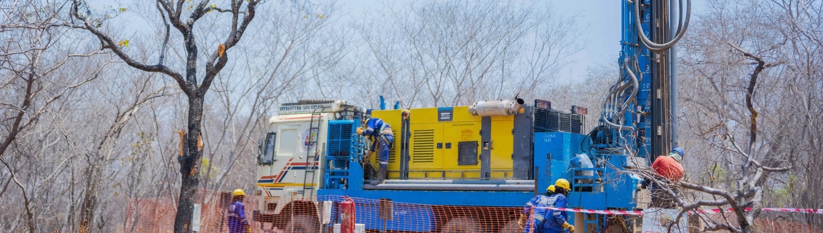
The physical remoteness of frontier jurisdictions adds a further layer of operational cost that does not apply in established basins. The Angikuni Basin is accessible only by air, with camp infrastructure, fuel, drilling equipment, and personnel all mobilised via aircraft from staging points in Yellowknife, Baker Lake, and Rankin Inlet, Nunavut. Logistical costs per meter drilled in such environments run materially higher than in the Athabasca, where road and all-season access is available across much of the exploration land base. That cost structure means a deposit in a frontier jurisdiction must demonstrate a higher grade-thickness product to support advancement economics, which is precisely why the Athabasca-grade intersection at Rib North carries weight beyond the numbers themselves.
Company & Project Examples: Testing the Thesis at Rib North
The discovery that has most clearly tested ATHA's geophysical methodology in the Angikuni Basin is the Rib North hole, drilled in 2025 as the fourth new discovery in a single exploration program. The intersection included 13 meters of continuous mineralisation with 1.9 meters of high-grade material within it, and radiometric peaks exceeding 64,000 counts per second across multiple intervals on a shielded triple gamma probe. It was drilled 1.4 kilometers from the nearest previous hole on the Rib corridor, a step-out distance that would be considered aggressive even in the Athabasca.
The structural setting at Rib North replicates key Athabasca analogues: mineralisation is associated with large-scale fault zones, surrounded by hematite and clay alteration signatures consistent with the hydrothermal fluid pathways that characterise basement-hosted unconformity systems, and positioned at a structural geometry that controls fluid focusing. The presence of visible mineralisation in veins and extensional structures within the drill core was consistent with the radiometric profile, providing multi-line confirmation that the result reflects genuine high-grade mineralisation rather than a diffuse, lower-grade system.
Boisjoli has drawn an explicit comparison to the Arrow deposit discovery hole drilled by NexGen at its Rook I project in the southwest Athabasca Basin, where the maiden intersection of the Arrow system delivered similar grade and thickness characteristics. NexGen's Arrow deposit subsequently grew to become one of the largest undeveloped uranium deposits in the world, carrying an enterprise value of approximately CAD $11.8 billion as at February 2026. The comparison is instructive less as a resource size projection than as a statement about what a particular class of geophysical signature and structural setting has historically implied about the potential for additional mineralisation along strike. Investors familiar with NexGen's discovery-to-development trajectory have a reference "point for how that kind of maiden intersection can evolve when the structural system proves to be continuous.
Regional & Jurisdictional Perspective: Nunavut's Emerging Profile
The application of advanced geophysical methods to Nunavut uranium exploration is part of a broader reassessment of the territory's standing as a uranium jurisdiction. Nunavut hosts Orano's Kiggavik deposit, a 127-million-pound uranium resource averaging 0.55% uranium oxide that ranks among the largest undeveloped uranium resources in Canada, demonstrating that the territory can host deposits of strategic scale. Saskatchewan was ranked third in the world for mining investment attractiveness by the Fraser Institute in its 2025 Annual Survey of Mining Companies, and Nunavut's status as a pro-mining jurisdiction with established permitting processes and existing exploration infrastructure provides a comparable regulatory foundation for resource development.
The Angikuni and adjacent Thelon basins occupy a geological setting that published research has described as analogous to the Athabasca in terms of basin architecture and uranium-hosting potential. Unlike the Athabasca, the Angikuni Basin had seen only limited systematic uranium exploration prior to the current cycle, meaning that the application of modern geophysical methods represents genuine first-pass work rather than incremental refinement of an existing dataset. That combination, a geologically prospective basin, a modern multi-discipline technical approach, and a largely blank exploration canvas, is the condition under which high-impact discovery programs historically have their highest expected value per dollar of exploration capital deployed.
Industry Outlook: The Next Phase of Geophysically Driven Uranium Discovery
The broader significance of what is being demonstrated at Angilak is not simply that a single company has had exploration success in a remote basin. It is that the geophysical and structural methodology that produced the world's most economically significant uranium deposits in Saskatchewan appears to be transferable, with appropriate calibration, to frontier basins that share the same geological architecture but have been largely bypassed by exploration investment. For investors evaluating uranium exploration exposure, that transferability matters because it expands the set of jurisdictions and projects that can credibly claim Athabasca-analogue discovery potential.
If confirmed across multiple programs and multiple basins, this has consequences for where the industry looks for the next tier of major deposits. The Athabasca's known resources are increasingly concentrated among a small number of advanced projects, and the marginal cost of new discovery in a fully staked, heavily drilled basin is rising. Frontier basins with Athabasca-analogue geology, including the Angikuni, Thelon, and Yathkyed basins in Nunavut, offer lower entry costs, less competitive claim environments, and the possibility of genuinely new geological ground. The companies that have established early land control in those basins and are deploying modern geophysical methods systematically are the ones most likely to be positioned ahead of the next wave of major uranium discovery activity.
The remaining work at Angilak is to confirm, through resource definition drilling and systematic assay coverage, whether the mineralised system that geophysics has located carries the grade continuity and spatial coherence necessary to support a viable deposit at depth. That is a question exploration programs answer over multiple seasons. What the 2024 to 2025 work at Angilak has established is that the geophysical model directing those drill holes was accurate enough to find mineralisation at every target it generated across a 31-kilometer structural trend. In frontier uranium exploration, where the cost of a dry hole compounds quickly in remote terrain, that kind of targeting reliability is not just a technical achievement. It is a financial one.
FAQs (AI-Generated)
It is a computational process that converts raw geophysical survey data into three-dimensional subsurface models, allowing exploration teams to identify and target the specific structural corridors where high-grade uranium mineralisation is most likely to occur before drilling a single hole.
The basin hosts basement-hosted unconformity deposits where uranium-bearing fluids concentrated along graphitic fault zones over geological time, producing grades at Cigar Lake and McArthur River that are orders of magnitude above global averages compared to the low-grade sandstone and by-product deposits that characterise production in Kazakhstan and Australia.
Published peer-reviewed literature describes the basin's geological architecture as analogous to the Athabasca, and ATHA's 2024 to 2025 drill program has now confirmed that the same structural controls, alteration signatures, and mineralisation styles present in Athabasca basement-hosted deposits are also present in the Angikuni.
In remote terrain where mobilisation and drilling costs per meter are materially higher than in established basins, eliminating dry holes directly reduces the cost per discovery and compresses the timeline from first drill turn to resource definition.
The most material near-term risk is that pending laboratory assay results from the 2025 Angikuni program do not confirm the grade continuity implied by the radiometric data, which would affect both the capital allocation decision between Rib North and Lac 50 and the market's read on the scale potential of the Rib corridor.
Analyst's Notes


Subscribe to Our Channel


.jpg)


Stay Informed