



Marimaca Hits 216 Meters of 0.96% Copper in Pampa Medina Central Zone



Marimaca returned 216 meters at 0.96% copper and 7.2 grams per metric ton silver at Pampa Medina, and step-outs extended the horizon 300 meters.
- Drilling in the central high-grade sulfide zone at Pampa Medina returned 216 meters (m) of 0.96% copper and 7.2 grams per metric ton (g/t) silver from a depth of 466 m.
- Higher-grade material within that interval returned 62 m at 2.20% copper and 21.5 g/t silver from a depth of 602 m.
- Step-out holes extended the mineralized sedimentary horizon 300 m to the south and west of the central corridor.
- Drilling near the southeast limit of the oxide and sulfide zones returned 222 m of 0.50% copper from 194 m depth.
- Scout reverse circulation holes to the north and northwest did not reach the target sedimentary horizon at downhole depths of 540 m to 700 m.
- Diamond drilling is underway to extend those scout holes into the deeper part of the basin.
Company Overview
Marimaca Copper (TSX: MARI | ASX: MC2) is a copper company operating in Chile's Antofagasta Region. Its principal asset is the Marimaca Oxide Deposit (MOD), and its Pampa Medina discovery lies approximately 28 kilometers to the east. Pampa Medina is a manto-style copper deposit, meaning the copper sits in flat, sheet-like layers rather than steep veins. It is hosted in sedimentary rock of Jurassic and Triassic age, with volcanic rock above it and older Paleozoic metamorphic rock beneath.
Central Zone Drilling Returns Thick Copper & Silver Intervals
One hole in the central high-grade sulfide zone at Pampa Medina returned 216 meters (m) of 0.96% copper and 7.2 grams per metric ton (g/t) silver from 466 m depth. Inside that interval, 82 m graded 1.72% copper and 16.3 g/t silver from 600 m depth, and 62 m graded 2.20% copper and 21.5 g/t silver from 602 m depth. Drilling across the central zone is on 150-meter centers within a defined area of interest measuring 3 kilometers (km) by 1.5 km.
The richest zones in that intersection were 14 m of 3.05% copper and 26.7 g/t silver from 606 m depth and 12 m of 3.25% copper and 36.7 g/t silver from 632 m depth, and a shallower interval returned 6 m of 2.00% copper and 12.0 g/t silver from 506 m depth. All intervals are reported as downhole lengths, and true widths are estimated at approximately 80% of the reported figures.
Vice President of Exploration of Marimaca Copper, Sergio Rivera, points to how evenly the grade holds across the target horizon:
"The consistency of the high-grade mineralization across the target horizon is remarkable, and drilling continues to demonstrate the strong lateral and vertical continuity of the stacked-manto system within the central zone."
Two further holes on the same 150-meter spacing struck faulting that formed after the copper was deposited, and both returned near-surface oxide material instead: 30 m at 0.61% copper and 4.2 g/t silver from 238 m depth in one, and 36 m at 0.77% copper from 184 m depth in the other, including 12 m at 1.58% copper and 3.2 g/t silver from 204 m depth.
Step-Out Holes Extend the Sedimentary Horizon
Step-out drilling outside the central corridor extended the mineralized sedimentary horizon by 300 m to the south and west. A hole drilled 300 m west of previous drilling returned 56 m of 0.95% copper and 4.2 g/t silver from 748 m depth, including 22 m of 1.80% copper and 9.7 g/t silver from 750 m depth and 8 m of 2.42% copper and 9.0 g/t silver from the same depth.
Drilling near the southeast limit of the historical oxide zone and the newer sulfide zone cut several stacked manto layers over a broad interval of 222 m at 0.50% copper from 194 m depth. That interval covered 18 m at 1.01% copper from 246 m depth in oxide material, 28 m at 1.07% copper from 322 m depth in mixed material, and 48 m at 1.05% copper from 368 m depth in sulfide material, including 12 m at 1.99% copper from 404 m depth.
A hole 150 m east of previously released drilling cut stacked manto layers across 104 m at 0.65% copper from 522 m depth, including 20 m at 1.28% copper and 2.3 g/t silver from 524 m depth. A second interval returned 40 m at 0.89% copper from 586 m depth, including 14 m at 1.36% copper and 4.0 g/t silver from the same depth.
Oxide & Near-Surface Results Across the Southern Ground
Drilling on the southern fence added deeper sulfide intervals alongside near-surface oxide material. One hole returned 28 m of 0.88% copper and 5.4 g/t silver from 594 m depth, including 16 m of 1.37% copper and 8.5 g/t silver from the same depth, plus 14 m at 0.96% copper and 7.3 g/t silver from 704 m depth. A hole 200 m to the west returned 10 m of 1.02% copper and 5.0 g/t silver from 552 m depth and was affected by late dikes.
Southwest of the historical oxide footprint, drilling intersected 26 m at 0.45% copper and 2.9 g/t silver from 88 m depth, and 32 m at 0.74% copper and 4.6 g/t silver from 302 m depth, both in oxide material. Deeper drilling in that hole encountered a zone of west-northwest-trending faults and dikes that formed after the copper was in place.
Copper at Pampa Medina was first identified near the surface in oxide minerals, and high-grade zones of copper sulfide minerals, where the copper is bound with sulfur, have since been identified at depth below the weathered material. Silver grades are elevated in both the oxide and the sulfide zones and are generally correlated with copper grade.
Scout Drilling Tests the Basin to the North & Northwest
Scout holes drilled with reverse circulation (RC) rigs north and northwest of the area of interest tested how deep the target sedimentary rocks begin. Four of them did not reach that horizon at downhole depths of 540 m to 700 m.
One scout hole intersected mineralization at the limit of RC capability, returning 8 m at 1.47% copper and 7.5 g/t silver from a depth of 580 m in volcanic rock, interpreted to lie above the contact with the upper sedimentary sequence, which the hole did not reach. Another cut the sedimentary horizon deeper in the sequence, including 8 m at 1.17% copper and 11.8 g/t silver from a depth of 578 m, before drilling stopped due to the technical limits of RC drilling.
Rivera links the northern results to the shape of the basin itself:
"Our drilling to the north and northwest is also providing important information on the geometry of the sedimentary basin, where the target sedimentary horizons appear to deepen beyond the practical limits of RC drilling. Diamond tails are now underway to test these areas. Pampa Medina remains open in several directions and is materially under-tested, and these results continue to strengthen our view that we are defining a large, high-grade copper-silver system."
The geological model Marimaca built after consolidating the project area in 2024 identified the lower sedimentary units, comprising interbedded sandstones, shales, tuffs, and conglomerates, as the priority drilling horizons.
Next Steps
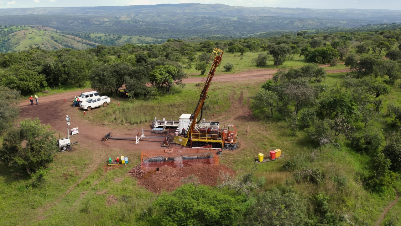
Diamond drilling is underway to the north and northwest to extend the scout holes that did not reach the target horizon. The 2026 campaign at Pampa Medina is focused on three goals: defining the high-grade central area of interest, delineating the identified oxide extensions, and further step-out drilling to test potential extensions of the broader system identified in geophysical work to date.
FAQs (AI-Generated)
Analyst's Notes





Subscribe to Our Channel









Stay Informed


