

6 Signals Behind ATHA's Case for a Basin-Scale Trend Beyond 3.4 Kilometers


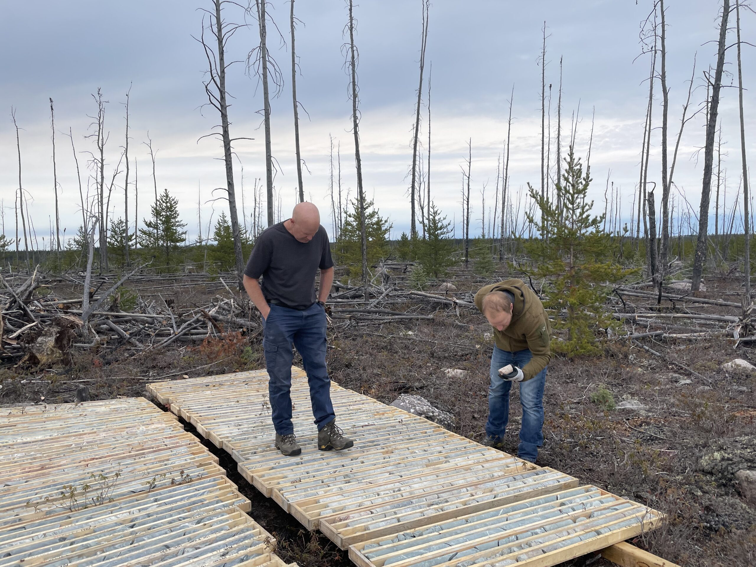
ATHA Energy ties 3.4 kilometers of Angilak uranium continuity to an orogenic model whose technical basis is the next test of its scale case.
Project Overview
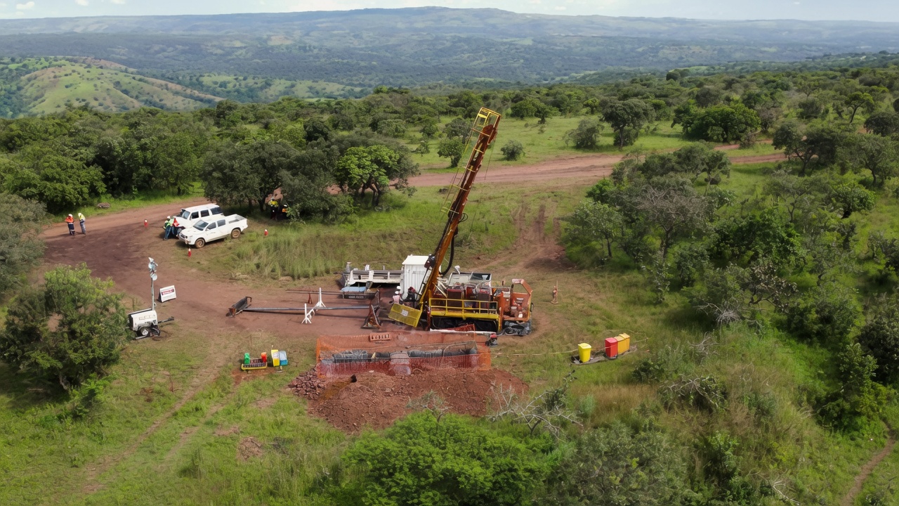
ATHA Energy (TSXV: SASK | FRA: X5U | OTCQX: SASKF) has concluded its 2026 Angilak Exploration Program at the 100%-owned Angilak Uranium Project in Nunavut. The drilling connected the RIB North and RIB East discoveries and expanded mineralized strike length on the Eastern Limb of the Mineralized RIB Corridor from 1.45 kilometers (km) to 3.4 km. ATHA has no known mineral resources at Angilak.
ATHA is working with subject-matter experts to interpret the uranium deposits at Angilak as the result of an Orogenic Uranium-Rich Deposit Model. Orogenic describes deposits formed along the deep fault systems of mountain belts. Management ties the model to the system's overall scale.
1. A Gold-Belt Framework Applied to Uranium
ATHA is applying a framework built on orogenic gold belts, whose plumbing systems and discovery potential are well documented within the gold sector, to a uranium system.
Chief Executive Officer and Director of ATHA Energy, Troy Boisjoli, reduces the interpretation to its structural core:
"At a 50,000-ft view, what that means is it's a large-scale, structurally controlled system. That has deep roots."
In a structurally controlled system, faults and shear zones govern where mineralization forms, and deep roots describe a system that extends to depth. Management describes Angilak's metal endowment as widespread, with the potential to become Canada's next uranium district.
2. One Controlling Structure Along the Eastern Limb
At RIB North, multiple stacked uranium veins lie within a mineralized envelope around 1 main controlling structure, a large-scale graphitic fault zone. Mineralization occurs around that fault zone and continues up-dip and down-dip along the structure’s slope into the ground. The 2026 drilling connected the 2 discoveries along the same mineralized shear-zone complex, and mineralization was found on 2 separate horizons: the Eastern and Western Limbs. The Mineralized RIB Corridor is mapped as 18 km of stacked conductors comprising 2 parallel limbs.
Eagle Point and Arrow show a similar stacked-vein style by management’s comparison, and both are basement-hosted uranium deposits, meaning the uranium lies in the older rock beneath a basin’s sedimentary layers. The 2026 program added insight into the rock-type and structural controls on uranium mineralization across the Angikuni Basin, and those insights guide ATHA’s prioritization of target areas. At the current drill spacing, the plunging mineralized trends within the envelope, the directions in which mineralized zones extend at depth, are not yet resolved. Infill drilling is the step that adds that detail.
3. Conductors as the Targeting Tool
Every conductive target ATHA has drilled at Angilak has been mineralized, a record management treats as support for the structural model. Conductors are zones of rock that carry electrical current more readily than their surroundings, and the conductive targets drilled at Angilak have proved to be graphitic and sulfidic structures. ATHA’s workflow moves from geophysics to drill data at that geophysics’ resolution, then to models of rock type, structure, and mineralization, and the conductive corridors imaged in its geophysics are its primary drill targets. In 2025, drilling on the Mineralized RIB Corridor produced 4 discoveries, RIB North, RIB East, RIB West, and RIB South, across a 12-km strike, with every hole mineralized. In 2026, 21 of 23 diamond drill holes on the corridor intersected uranium, including all 7 of the final holes.
Boisjoli treats the holes that were missed as data for the model:
“I’m a very strong, very firm believer that you learn just as much from the holes that don’t intersect mineralization as the ones that do.”
ATHA feeds its misses into the model alongside its hits to improve the outcome of later drilling.
4. Drill Coverage as the Limit on the Eastern Limb
Only the drilling completed so far limits the 3.4-km Eastern Limb in management’s view, with no geological boundary, cutoff, or crossing structure ending or starting the mineralized zone.
Boisjoli separates the drilled length from any geological edge:
“The 3.4 kilometers that we have outlined now are only constrained by the work that we’ve done. There’s no geologic constraint on it.”
The 2026 program was designed to test, through aggressively wide step-outs, an area with the potential to host a Tier I deposit, one large enough to support a long-life mine. At the northeast extent of the tested Eastern Limb, a hole sits about 1.2 km northeast of the 2025 discovery hole. It intersected 5.5 meters (m) of total composite uranium mineralization across 6 zones between 490.5 m and 687.5 m downhole. On the Western Limb, a second horizon has been traced over about 220 m, with early indications that it may connect with the RIB West discovery over a possible strike length of about 3.0 km. The corridor remains open and unconstrained for potential future northeast step-outs that can test the no-boundary view, and management describes the system as open in all directions.
5. From 3.4 Kilometers to a Basin Edge
Angilak’s scale case ranges from 3.4 km of drilled continuity to tens of kilometers of anticipated strike length, in a basin only recently explored for uranium. Management estimates about 17 km of contiguous mineralization around the RIB structural trend and anticipates that the trend extends along the entire edge of the Angikuni Basin. It compares that span with the stretch from Cigar Lake to Rabbit Lake, the majority of the eastern Athabasca Basin’s producing area. The potential strike length in that comparison is tens of kilometers and possibly more than 50 km. The Athabasca Basin has produced over 900 million pounds of uranium oxide.
The corridors defined so far are 3 areas along a 31-km trend. They are the 21-km Lac 50 Deposit Corridor, where about 24% of the Lac 50 Deposit Model has been tested, the 18-km Mineralized RIB Corridor, and the 14-km KU-Nine-Iron Corridor. Drilling on the KU-Nine-Iron Corridor returned grades up to 1.56% uranium oxide, and 3D electromagnetic inversion modeling, which turns electrical survey data into a 3D model of conductive rock, identified multiple untested targets along the trend.
6. What the Write-Up Has to Show
The model's technical documentation and the next Lac 50 Deposit Corridor results are the pending results that will test the scale case. As of October 7, 2026, ATHA planned to document the foundation of the orogenic interpretation and to release preliminary results from the Lac 50 Deposit Corridor, including the Lac 50 NW discovery area. Those results come from a corridor outside the Mineralized RIB Corridor, where the 3.4 km was drilled.
Assay samples from the 2026 holes have gone to the Saskatchewan Research Council laboratories in Saskatoon. The 2026 widths are preliminary downhole gamma-probe readings taken along the core, and the true thickness has yet to be determined. ATHA collects an oriented core from every hole, providing a direct measurement of each mineralized structure’s orientation. The next phase is a high-confidence delineation program within the parameters set by the 2026 drilling, and ATHA intends to direct a portion of its work to discovery along additional trends. The C$63 million raised in the first quarter of 2026 provides runway through the 2027 program.
Key Takeaways for Investors
- ATHA Energy is applying a framework built on orogenic gold belts to its Angilak uranium system and ties the model to the overall scale of the project.
- Management treats the mineralization from every conductive target drilled at Angilak as supporting the structural model.
- The 3.4-kilometer Eastern Limb has no geological boundary in management's view, and its northeast end is open to step-out drilling.
- Management anticipates that the RIB structural trend extends along the entire edge of the Angikuni Basin, with a potential strike length of tens of kilometers.
- The scale case now waits on the model's technical documentation and the next Lac 50 Deposit Corridor results.
Bottom Line
ATHA Energy closed its 2026 program with 3.4 km of continuous mineralization on the Eastern Limb of the Mineralized RIB Corridor, and every conductive target it has drilled at Angilak has been mineralized. Through the orogenic interpretation, management links the drilled length to a trend it anticipates along the entire edge of the Angikuni Basin, with potential strike length in the tens of kilometers. As of October 7, 2026, ATHA planned to document the technical basis for the model alongside results from the Lac 50 Deposit Corridor, and that documentation is the next test of the link. The C$63 million raised in the first quarter of 2026 provides runway through the 2027 program, and the next phase is a high-confidence delineation program with a portion of the work directed toward discovery along additional trends.
Analyst's Notes





Subscribe to Our Channel








Stay Informed